
Hawaii became a U.S. state in 1959.It is an archipelago of one hundred and thirty-seven volcanic islands situated in the Northern Pacific Ocean. The eight major islands are: Oahu, Maui, Kauai, Molokai, Lanai, Niihau, Kahoolawe and Hawaii aka, The Big Island.
Kauai is the oldest island and at approximately 1,430.00 square kilometres/552.0 square miles, the fourth largest. It has an estimated population of 72,000. Despite a lingering nervousness of heights, I accompanied my husband on a helicopter tour. Facing this fear provided me an opportunity to view Kauai from a perspective otherwise impossible to appreciate. I hope you enjoy the photos that I snapped during our one-hour morning adventure.
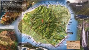
Souvenir map of helicopter ride over Kauai Island.
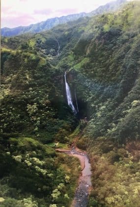
Can you find the airplane in this deep valley?
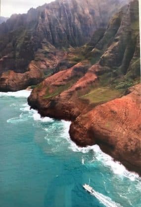
The boat in the lower right corner offers a great perspective of the Na Pali Coast.
